Cycling and hiking routes
Liberation Route Brabant hiking trail
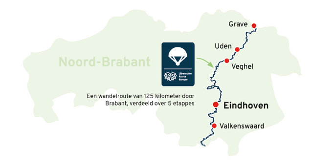
The Liberation Route Brabant leads you past historic sites that played an important role in the final phase of World War II. The trail is part of the European LRE Hiking Trail. The Brabant Stage follows the Airborne Footpath and tells the story of Operation Market Garden. The route in Brabant starts from the border crossing at Lommel (B) towards Valkenswaard. Through five stages totaling 125 kilometers, you walk to Grave, where the route leaves the province again. The route follows the junction network. There are special “Liberation Route Brabant” shields that mark the route as well as monumental signposts called “Vectors of memory” that mark key locations along the route. Along the way, many stops can be made at museums, monuments, cemeteries and other historical sites that recall the final phase of World War II.
Order the special hiking map that shows the route along the hiking nodes and main attractions in the municipalities of Brabant. The walking route map is available at tourist information points (VVV), VisitBrabant partners and can be ordered through VisitBrabant’s web shop.
Order the hiking map

Liberation Route Brabant bicycle routes
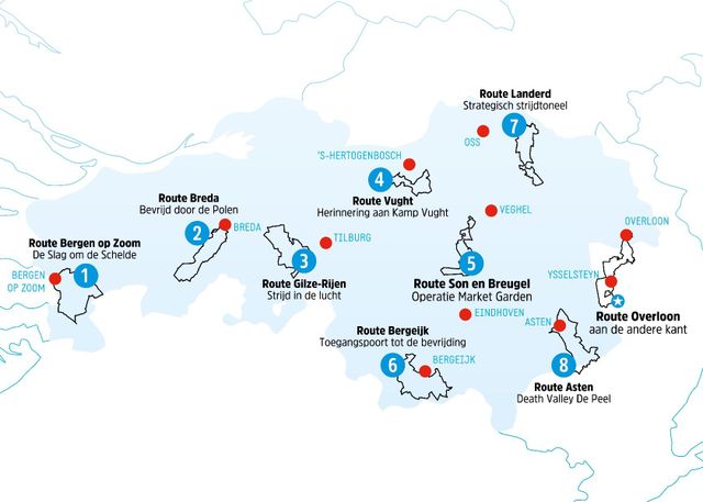
The Liberation Route Brabant tells the story of the liberation, but also shows what World War II meant to ordinary Brabanders. Eight bicycle routes, scattered across North Brabant, will lead you past Brabant Remembers stories, Liberation Route Europe listening columns, monuments and museums, which together make visible the impact of war on North Brabant.
The Liberation Route Brabant is plotted along the Brabant bicycle junction network. At each junction, you’ll find a sign reading “Liberation Route. The eight bike maps are available separately, but a deluxe gift box containing the complete set of maps is also available. For detailed information on biking and hiking routes, visit visitbrabant.com.
Order bicycle maps

